September 13th, 2024
My next destination is in the Uinta (yoo-in-tuh) mountains of Utah. I left the Riverside Campground just below the Palisades Reservoir at 6:30 a.m. My plan was to make stops along the way south, to take care of various tasks.
The first task was to get some breakfast. I drove 15 miles to Alpine and stopped at Yankee Doodle’s Cafe. The breakfast crowd on a Tuesday morning was 2, including me. Around the corner from there, was an Exxon station where I could get one of my 2 propane tanks filled. When I disconnected and unmounted the tank, it seemed to heave for an empty tank. It turned out to only be about 1/4 empty. My propane sensor on that tank had malfunctioned due to dirt in the sensor. I cleaned it off and headed to my next stop, the laundromat in Afton. A load of clothes washed, dried and folded took about 1 1/2 hours.
Next, I wandered around Evanston, Wyoming, trying to get to the Walmart for food and water. The bridge over Interstate 80 was closed for repairs. I followed the detour, only to be warned that this had an underpass with a height of only 10 feet. My trailer is 11 feet. There was a truck detour for that underpass, but all it did was take you in a circle back to the overpass that was closed. I had to ignore the Apple and Google maps, and resort to manually using the map to discover a work-around. Sometimes A.I. is really A.S., Artificial Stupidity. You apparently can’t teach a machine to figure out what road construction people are going to scramble up.
I got a few things at the Walmart and then topped off my gas tank. My truck still showed a range of 180 miles, but you get a warning at 50, so you really only safe can count on 130. The distance to the campground was 54, possibly leaving 76 miles, but it was all uphill and I also needed enough miles left over, to get to the next gas station after leaving the campground. Best to be safe.
This last 54 miles turned out to be quite interesting. At the Walmart, the temperature was 80 degrees and sunny. As I approached the climb up to the Mirror Lake Pass, about 4000 feet higher in elevation, I could see rain squalls. By the time I reached the rain, the temperature had dropped from 80 to 41. And then the dry road turned into 1 1/2 inches of snow cover. After about 5 miles of that, I had to pull into a turnout with a small amount of Aspen cover, as marble size hail started hammering the truck. When this stopped, the temperature went back up to 55 with rain. This melted the snow quickly. I got to the campground and started setting up, but had to shelter due to lightening strikes all around. The sun began to peak out occasionally, but the temperature stayed at about 50. This all sounded bad, but after the long weeks of heat, the cool air felt very nice. There was a nice hint of fall in the air.

I found a nice site in the newly renovated Washington Lake Campground. However, the ever confusing U.S. Forest Service, made the campground “First Come First Serve” (FCFS) from September 2nd through 13th. On the 14th, they switched it back to Reservation Only until the fall closure on the 21st. So, I was only to get 4 days at the campground, as on the weekend, all sites had been reserved. DUMB! I only took 3 days, as the 4th day would have had me moving on a Saturday, which would be a problem due to weekend crowds. It would be best to move early on Friday in order to find a “FCFS” site somewhere before the Friday afternoon rush.
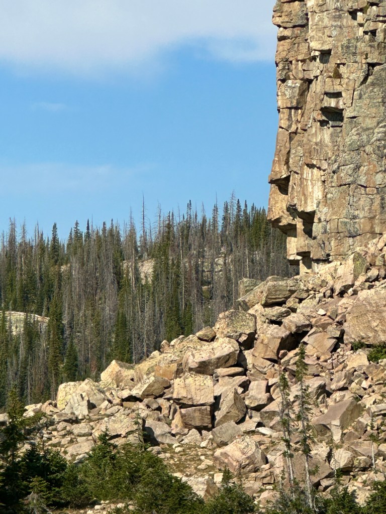
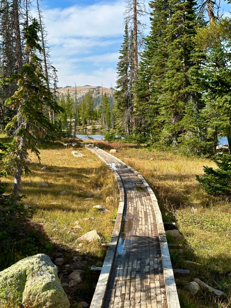
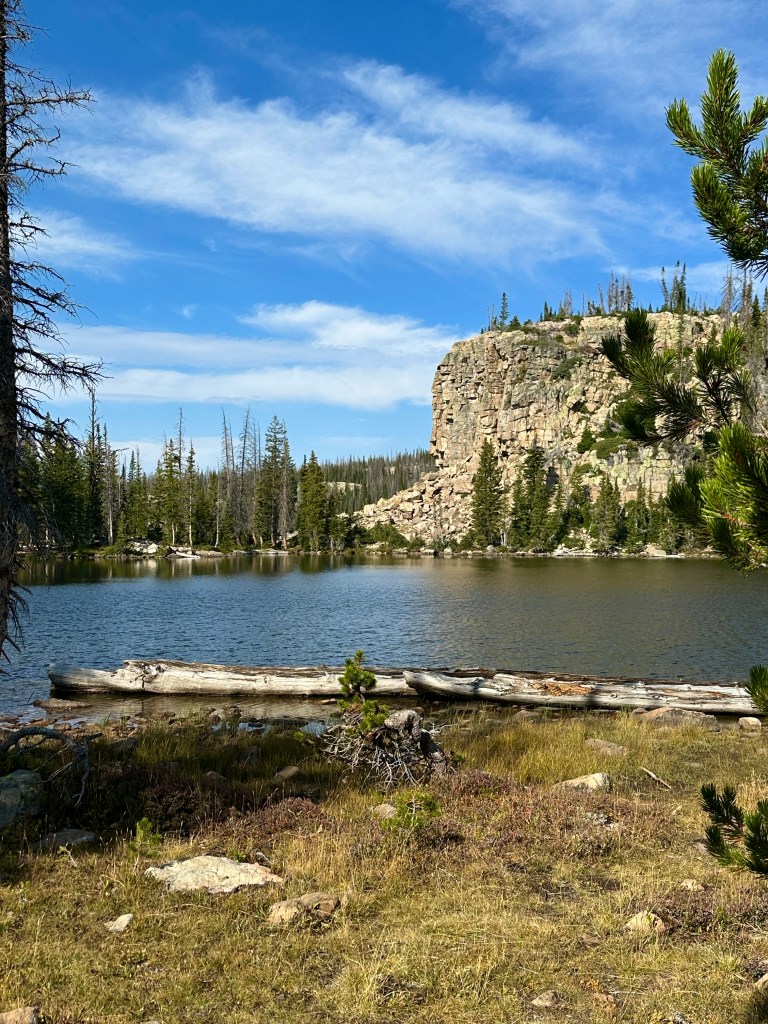
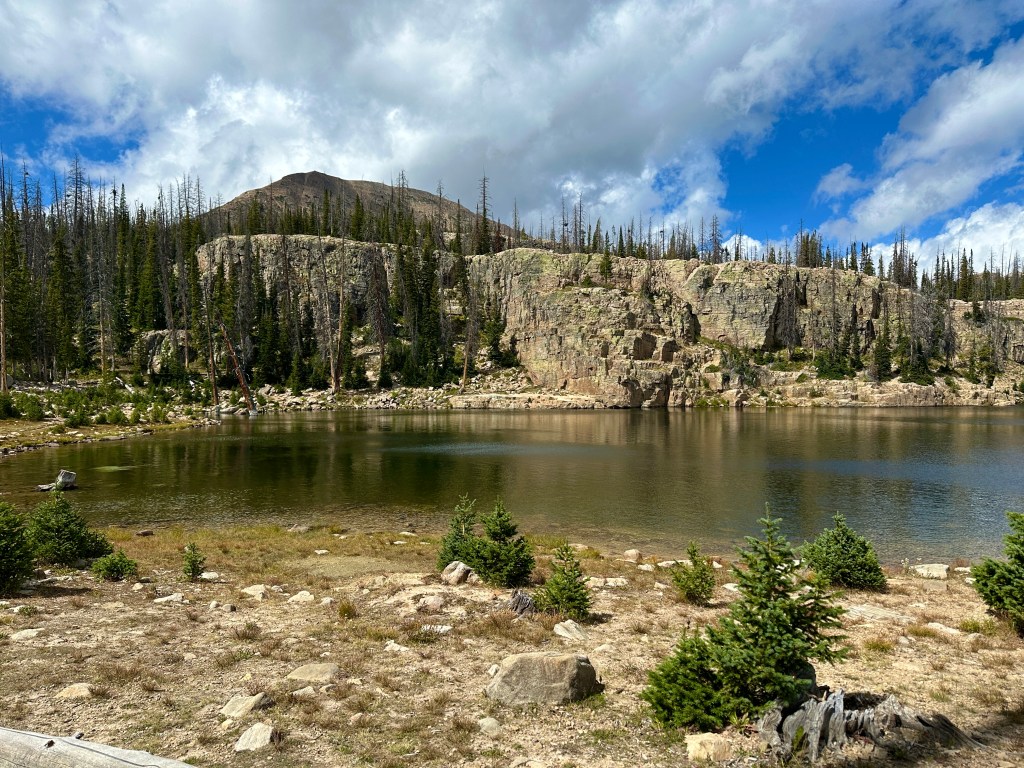
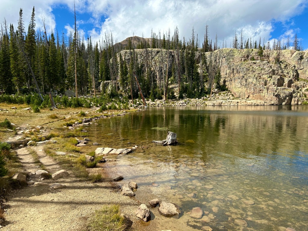
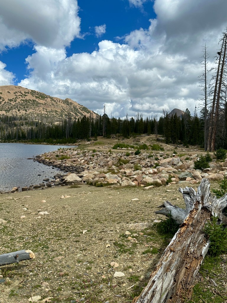
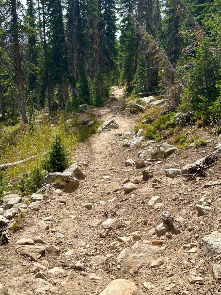
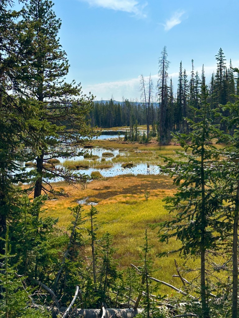
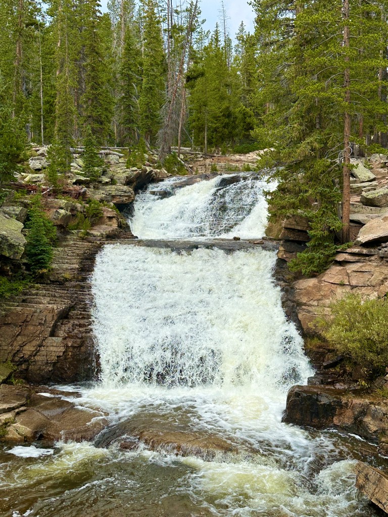
I spent a couple of days hiking in the area. The first day I looped up and around Cliff Lake and the second day’s destination was Wall Lake. The trails were very rugged, with lots of rocks and boulders. The undergrowth and small ponds were starting to show a hint of fall colors.
I packed up and drove down to a lower elevation along the Provo River. I found a decent campsite, but it had a pretty good amount of tree cover. So, I had spotty satellite coverage and no cell coverage. I had to move the solar panels a lot in order to keep them in sunlight.
The first afternoon at the new site, I decided to drive the 18 miles down to the valley town of Kamas. I had lunch at Subway, looked around town, and then headed back up the Mirror Lake Highway, Route 150, to the camping area. I noticed right away that the local people had a sense of humor. As I drove east, I entered the backwards part of town and entered the village of Samak (Kamas backwards). Samak is on Beaver Creek. As I passed out of the village, I came to a large ranch with the sign “Beaver Creek Nudist Resort”. I didn’t visit, as I thought I was probably over dressed.
I will be in the Uintas for a few more nights. That will bring me past the weekend, which will make it easier to find another FCFS site. I am hoping to find one near a place I often visited back in 1992-1993. It is named after a famous historical character of the old west, who was later played by one of my favorite actors in a classic western film. Can you guess? Hint: It won 4 Oscars and was nominated for an additional 3.
