August 26th, 2024
After breakfast in Challis, I drove south on Route 93, the Peaks to Craters Scenic Highway. It travels the length of the Lost River peaks down to the Craters of the Moon National Monument. The road crosses a cattle ranching plain just south of Challis before entering the steep walled Grandview Canyon along Warm Springs Creek. It gradually climbs before crossing a divide at Willow Creek Summit (7,161 ft.) and descending into the Thousand Springs Valley. This valley is trapped between the Lost River Range on the east and White Knob Mountains on the west.
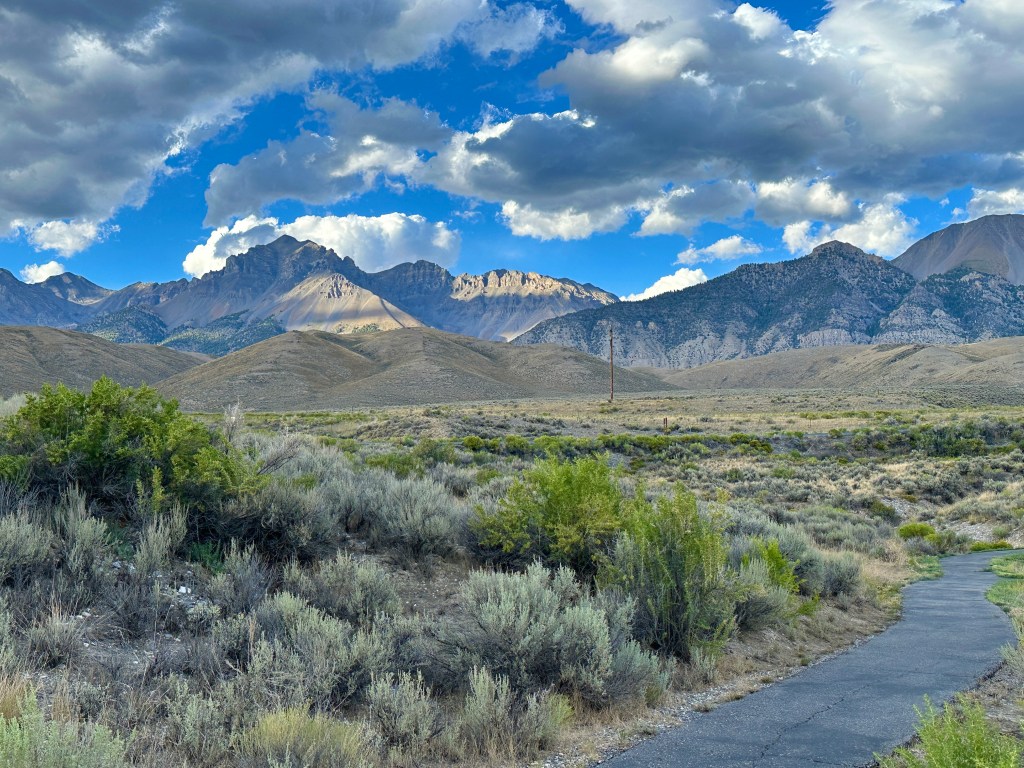
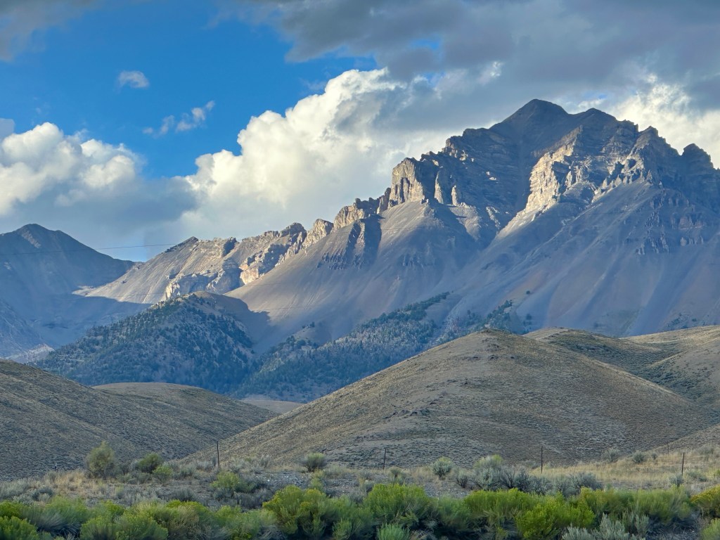
The Lost River Range is one of the major Idaho ranges with a number of peaks of 12,000 feet or more, making the drive down the valley very scenic. Idaho’s tallest mountain, Borah Peak is found there at 12,655 feet of elevation.
Big and Little Lost Rivers flow southeastward along either side of the Lost River Range. They were given the “Lost” moniker as both rivers disappear just to the south of the range. There, the north slope of the Snake River plain is a vast lava bed where the waters of the rivers seep into an underground aquifer. Their flow continues underground until reappearing at Thousand Springs on the Snake River near Hagerman.
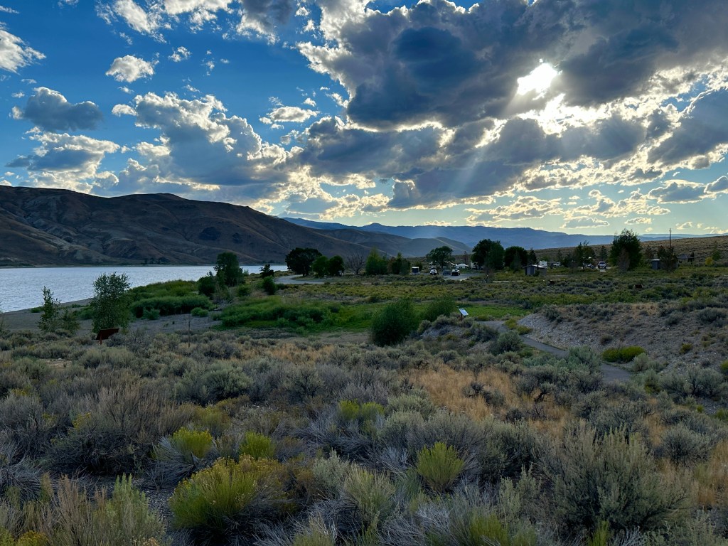
I managed to pull into the only vacant campsite at Joe T. Fallini BLM Campground on Mackay Reservoir. This is another excellent BLM facility in Idaho, having a paved road and paved sites with electric and water hookups. I paid only $9 per night. So I signed up for 12 nights. This is a longer stay than normal, but I needed to use up days while setting myself up to strategically secure a campsite somewhere just prior to the crowds of the Labor Day weekend.
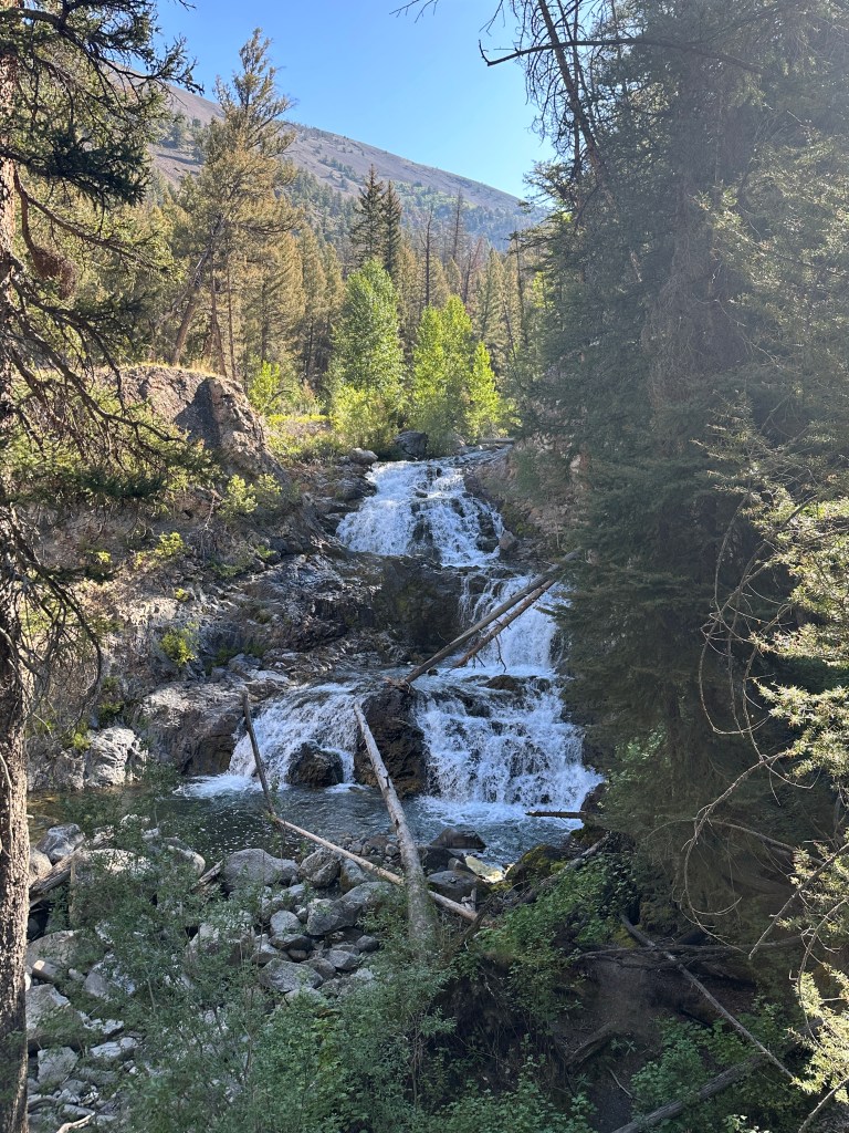
For my first hike in the area, I chose to drive northwest to Fall Creek. At the end of the road trailhead, was the path up to a waterfall. What do you suppose the name of the fall is? Why it is Fall Creek Falls of course. I wondered whether the creek was named after the falls, or the falls was named after the creek. On the trail I met a group of 8 backpackers headed up to Moose Lake. I imagine there are moose up there, otherwise it would surely be called Falls Lake.

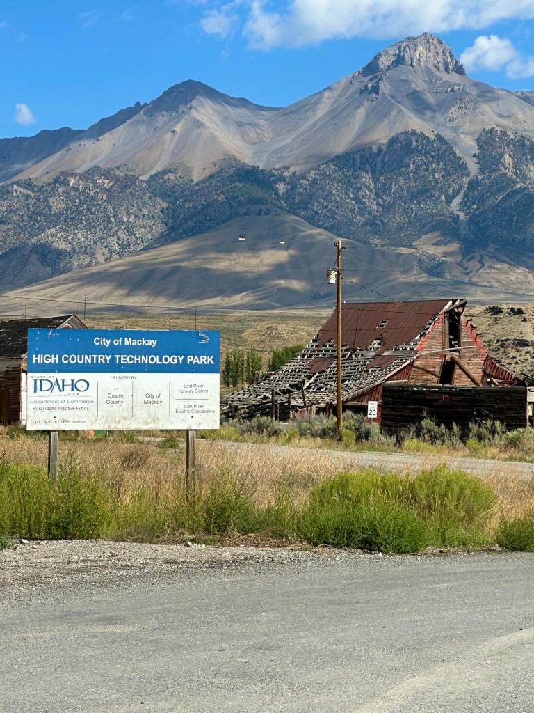
The next day, I searched on Google, and found that there was a laundromat in the nearby town of Mackay. When I arrived there, the sign on the door said “Open” and the time was correct. However, it was closed. I had no way of knowing if it was closed permanently. Many times I have found places to be closed or completely non-existent in these small towns due to the COVID pandemic. Barely thriving businesses appear to have often been victim to the policies of 2020 and 2021. I headed south to the next town, Arco, where I found an open laundry location.
I passed back through Mackay on my way back to the campground. I called the town Mac-kay. But, someone told me it was pronounced Mac-kee. So when I said it that way, someone else corrected me saying it was Muck-eye. The lady at the Challis Visitor Center, however, also said it was Mac-kee, so I am going with that. Nothing is ever simple.
Later in the week, I decided to drive a loop over to the valley east of the Lost River Range and back. My maps showed a good road going over the Doublespring Pass to the north and returning to the south over the Pass Creek Road and down through Blue Jay Canyon. It appeared on the map as though this route would be on narrow paved roads. However, it turned out to be all gravel, some of which was one lane. Fortunately, the mountains and eastern valley are somewhat remote and I only met one other vehicle on the 3 hour trip. I didn’t need 4 wheel drive, but did benefit from having a high clearance vehicle.
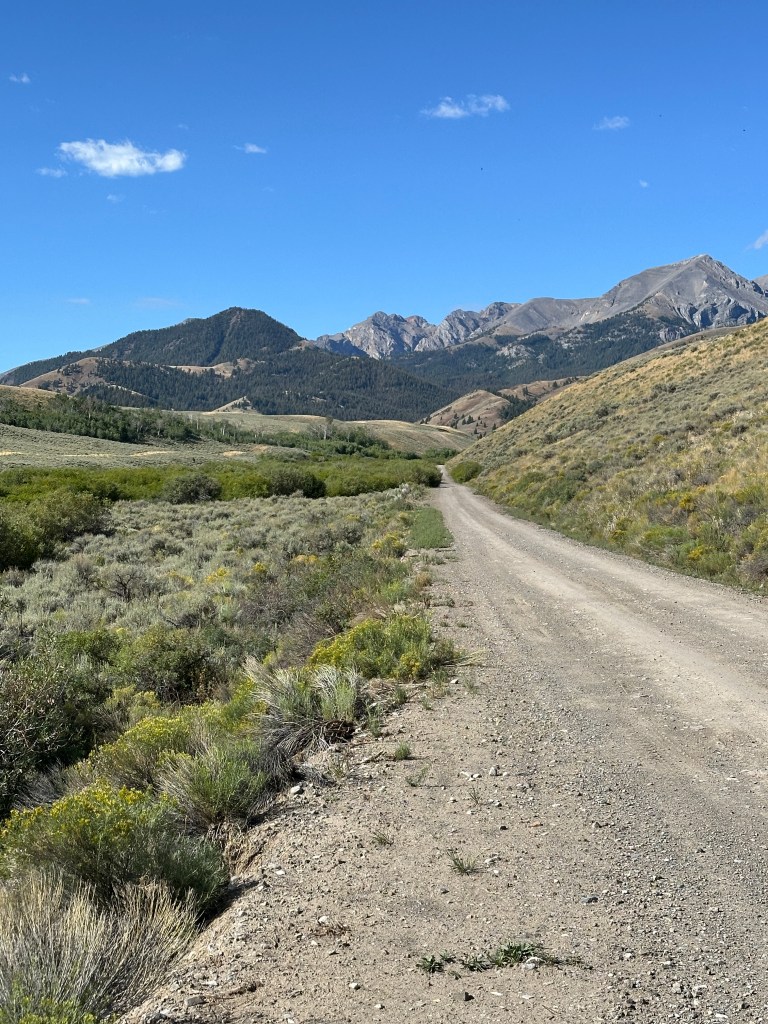
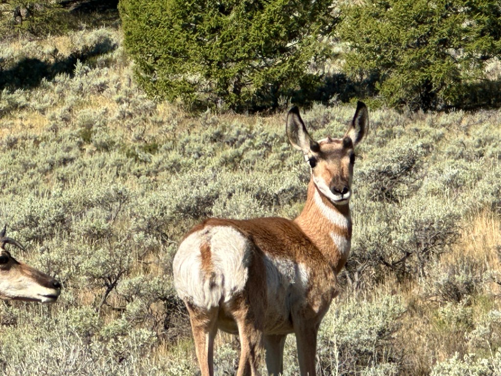
The drive was scenic and I observed Pronghorn, Mule Deer, Sage Grouse, and a badger. Blue Jay Canyon was very narrow and steep, keeping me in my 2 lowest gears to keep from overheating the brakes.
The rest of the week was very relaxing with occasional naps during the short afternoon and early evening thundershowers. Temperatures began to drop in the area, to temperatures you would more expect in these higher elevations. Afternoons tended to be in the high 60s or low 70s, with night times down in the 40s.
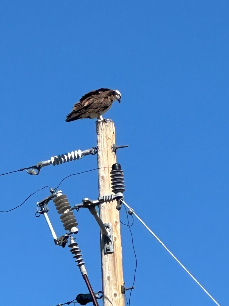
I had an daily visitor, that often landed at the top of the power pole next to my campsite. The Osprey, flew right by my window most days and one afternoon, I saw it pass by and land on the pole with a trout in its talons. It was very strange to see a trout flopping around on top of a utility pole.
My stay is coming to a close here and I will soon attempt to get a campsite back at Craters of the Moon National Monument for the Labor Day weekend. If I am successful, that will close my loop through Idaho and Montana after 86 days and 1,700 miles.
