October 26th to October 30th, 2022
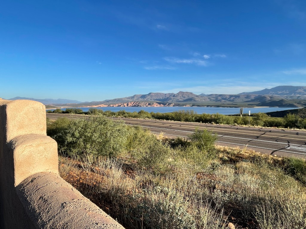
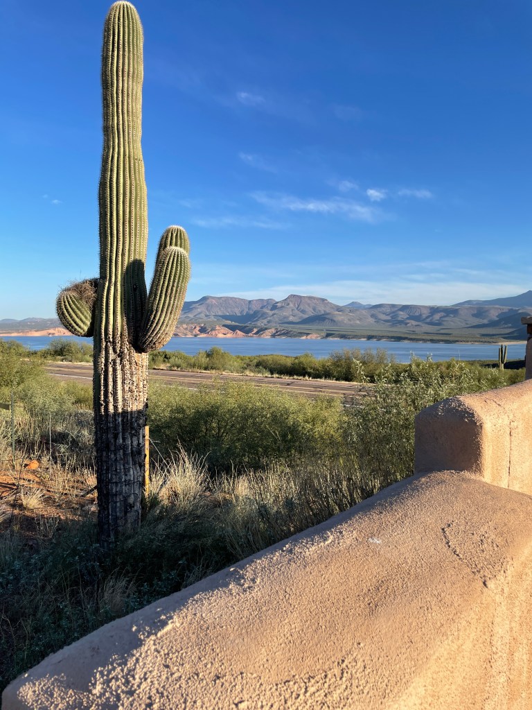
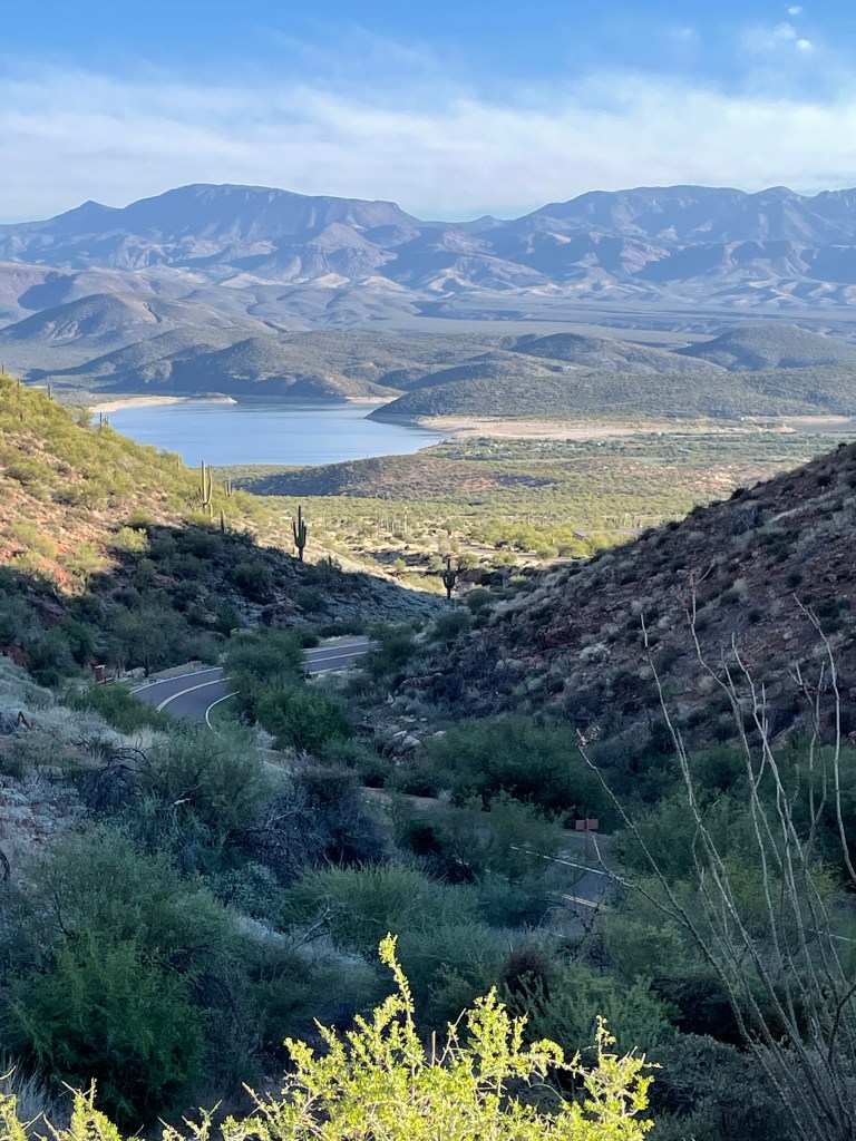
I left Payson, AZ heading south on Hwy 87 towards Roosevelt Lake. The road was winding and hilly. I left the Ponderosa Pine and Juniper forest and descended into the desert. Saguaro cactus began to appear on the hillsides. I passed through the area of Tonto Basin, just north of Roosevelt Lake. The lake is a 22 mile long and 2 mile wide reservoir, formed by the dam dedicated by Theodore Roosevelt in 1911. It provides recreation and water for Phoenix and nearby towns. My plan was to camp somewhere along its shoreline.
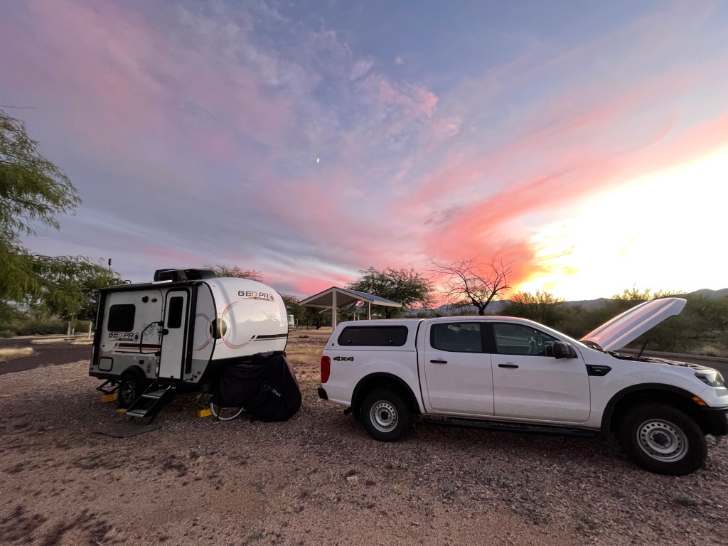
About half way down the lake, I crossed over the Roosevelt Bridge from which you can view the dam at the head of Apache Canyon. In a few miles I passed Tonto National Monument. There is a visitor center there where information is provided about the Salado Indians and their 2 nearby cliff dwellings. I planned to come back to do some hiking there the following day. Ten miles further down the road, I checked into Schoolhouse Point Campground for 5 days.
October is the “shoulder” season for Roosevelt Lake. People flock to the lake during the summer, despite temperatures in the 90s and 100s. They come to play in the lake with their ski boats and personal water craft (the kind with motors, not paddles). The water is warm, but is cooling compared to the air. In the fall, the boaters disappear and are slowly replaced by fishermen in winter. I was camping in the brief period between the two. The Schoolhouse campground had about 50 sites. Only 3 or 4 were occuppied, and they stayed pretty far apart from each other. You had a feeling of isolation.
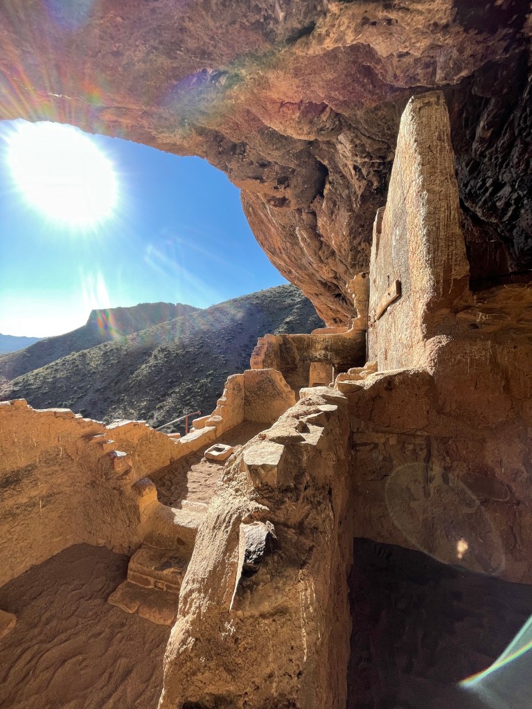
On Friday, I arose at dawn and headed to the National Monument. The gate was closed until 8 a.m. I had a while to wait. Once entered, I drove to the visitor center where I had to wait a few minutes for the ranger to open the gate to the trail leading up to the lower cliff dewlling. The hike would be about a half mile one way, but would be all up hill. From the visitor center you could see the overhanging cliff.

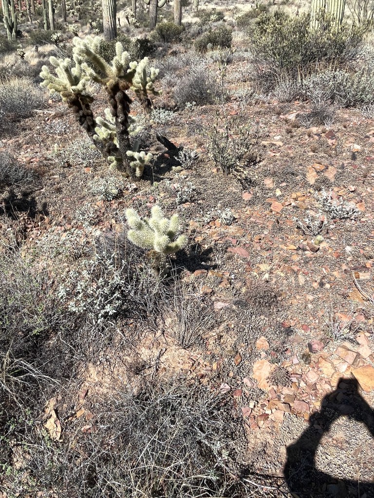
As this was a much lower elevation than I had been previously, the climb was not difficult. The air was still a crisp 54 degrees and there were numerous plaques along the trail describing the cactus, plants and small trees. Nearly everything described was covered in thorns. From a distance you could see Teddy Bear Cholla, looking soft and huggable from a distance. Up close you discovered that if you did, you would be looking for the nearest emergency care facility. Occassionally, small lizards ran across your path.

A ranger was assigned to the dwelling for 3 hour shifts. Since I was the only hiker arriving that early, we talked for nearly an hour about the dwellings and what it would have been like to live there. The cliff was eastward facing. After the sun rose above the opposite ridge, you would have a few hours of sun with cooler air. Then a little before noon, the overhanging cliff shaded the rooms, providing a respite from the afternoon heat. Even at mid-morning, I could feel a ten degree difference from outside air and that inside the rooms whose roofs were still intact.

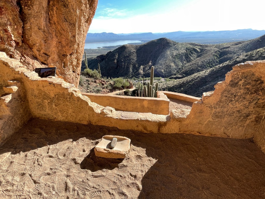
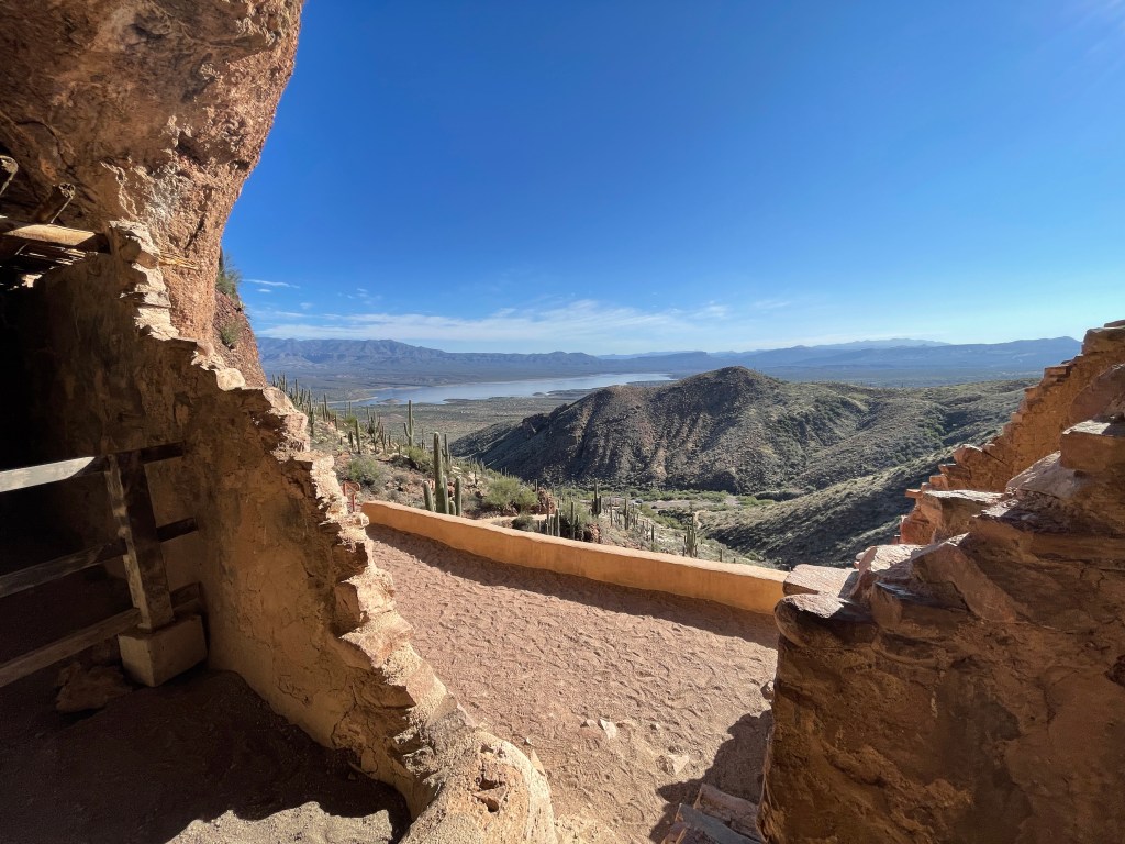
Nobody knows what happened to the indians living in the area dwellings, but at some point, they just abondoned the cliffs. Historians speculate there was a long drought, making their agricultural way of life impossible, or that perhaps there was strife with external tribes.
On Halloween of 2022, I abandoned the lake, and headed southeast to my next destination, another area known for it’s tribe of Indians.