Thursday, September 29th, 2022
I left Fruita and Capitol Reef National Park after my one night stay. Back on Utah Highway 24, I didn’t have far to go before coming to the town of Torrey. There I filled my gas tank, and turned south onto Scenic Byway 12.
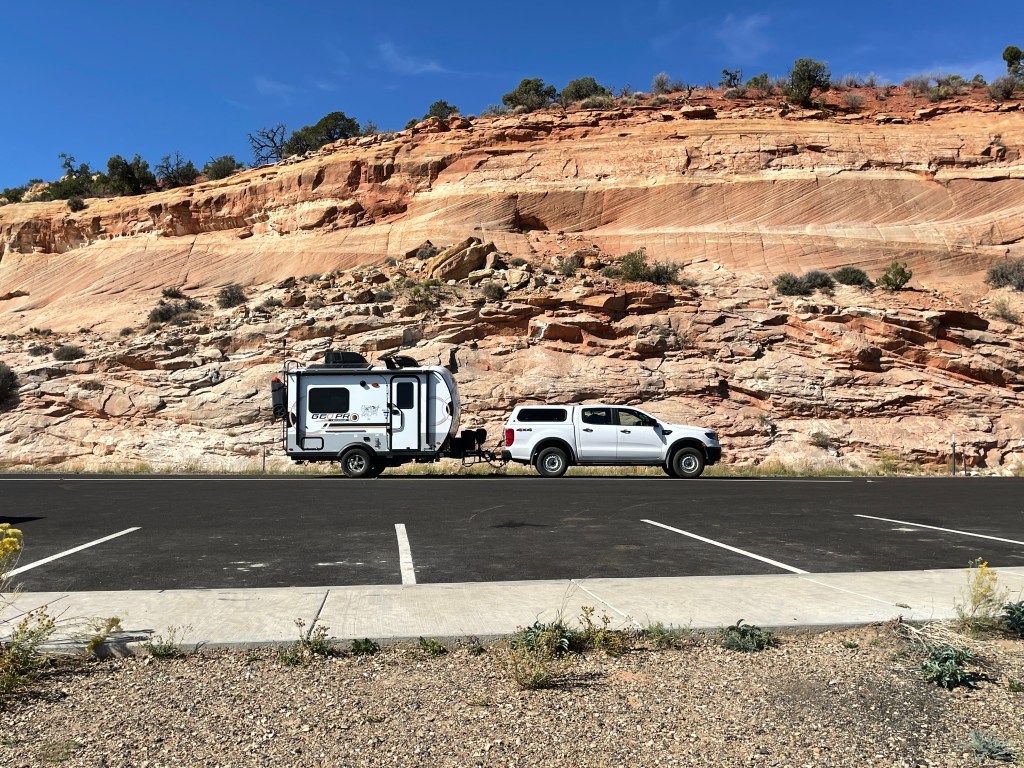
This route is rated as one of the most scenic roads in Utah. It starts by climbing through hills into the pine forested Dixie National Forest. As elevation increased the groves of aspen trees began to show their yellow fall colors. The road climbs to 9,500 feet and then begins a long descent to the Boulder, entering the canyonlands of Grand Staircase-Escalante National Monument’s Canyons Unit. A hint of things to come arrives when Hells Backbone Road merges with 12. The drive took me down an ever narrowing ridge with an 8% grade until I broke out of the low Juniper forest and saw the open winding road start its quick descent down the Hogback. This shoulder-less road is exposed to deep canyons on either side. A blowout on a front tire could easily throw you off either side with nothing to stop you for hundreds of feet. It is not a drive for the faint of heart. Were it a windy day, I would not have continued on with a swaying travel trailer.
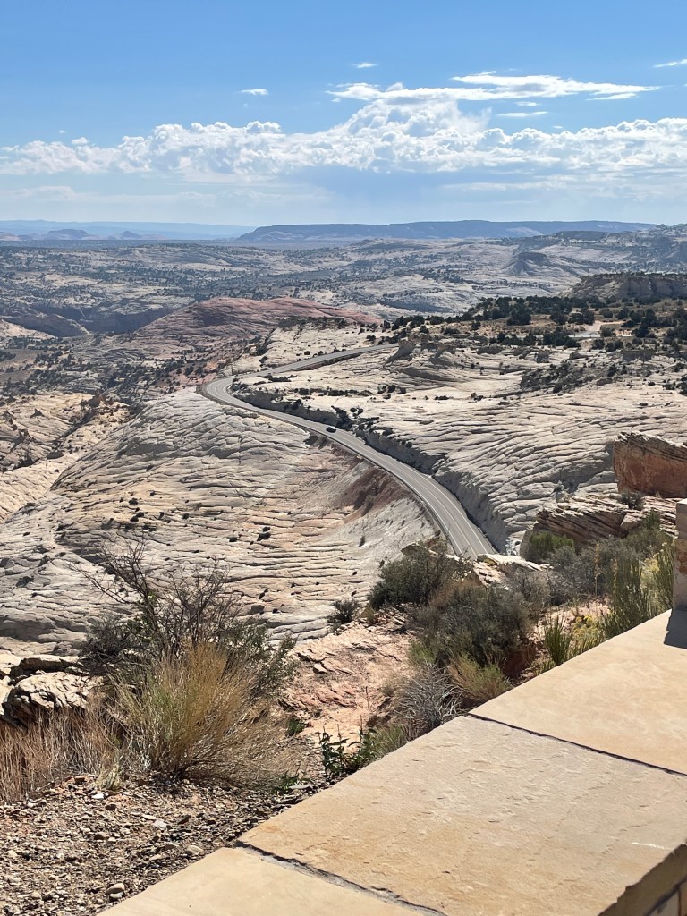

At the bottom of the slope, the road makes a 180 degree curve as it crosses over the Escalante River. Then you climb again over a high ridge of rock before descending to the town of Escalante. There Highway 12 ends its south westerly course and turns north to the small town of Tropic, just to the east of Bryce Canyon National Park, my destination for the day.
The park has 2 campgrounds. The North Campground requires a reservation, which you are not likely to get unless you planned months ahead. The Sunset Campground, further up the park road, is “first come first server”. As it was still the middle of the week, I decided to take my chances and see if any sites were available. I drove through Loop A and surprisingly it appeared that there were a good number of vacancies. The campground host told me that oddly, most campers had left that morning. There appeared to be no particular reason other than a forecast of daily temperatures in the 60s and lows near 40 for the next week.
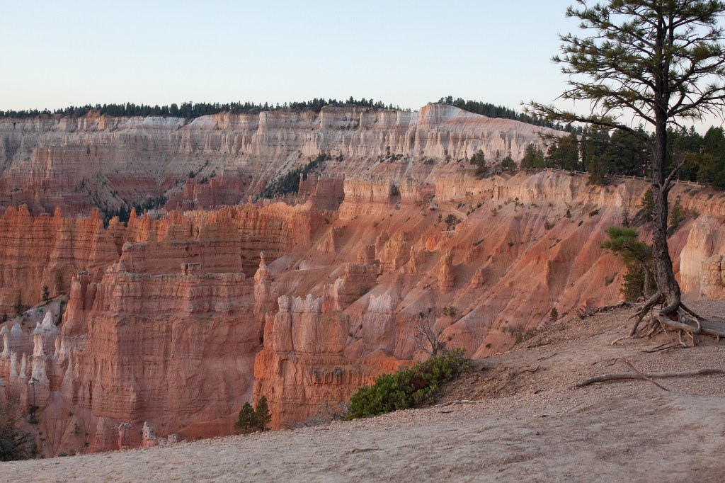
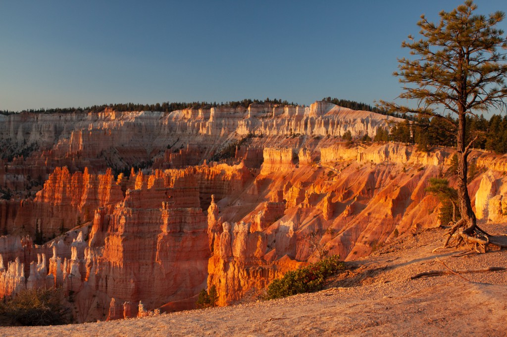
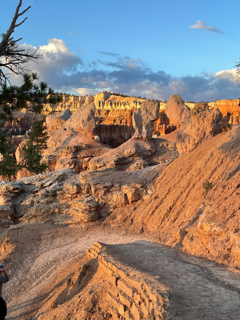
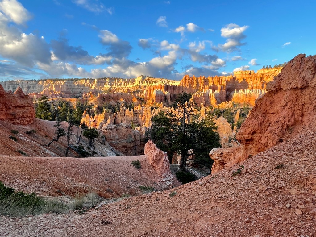
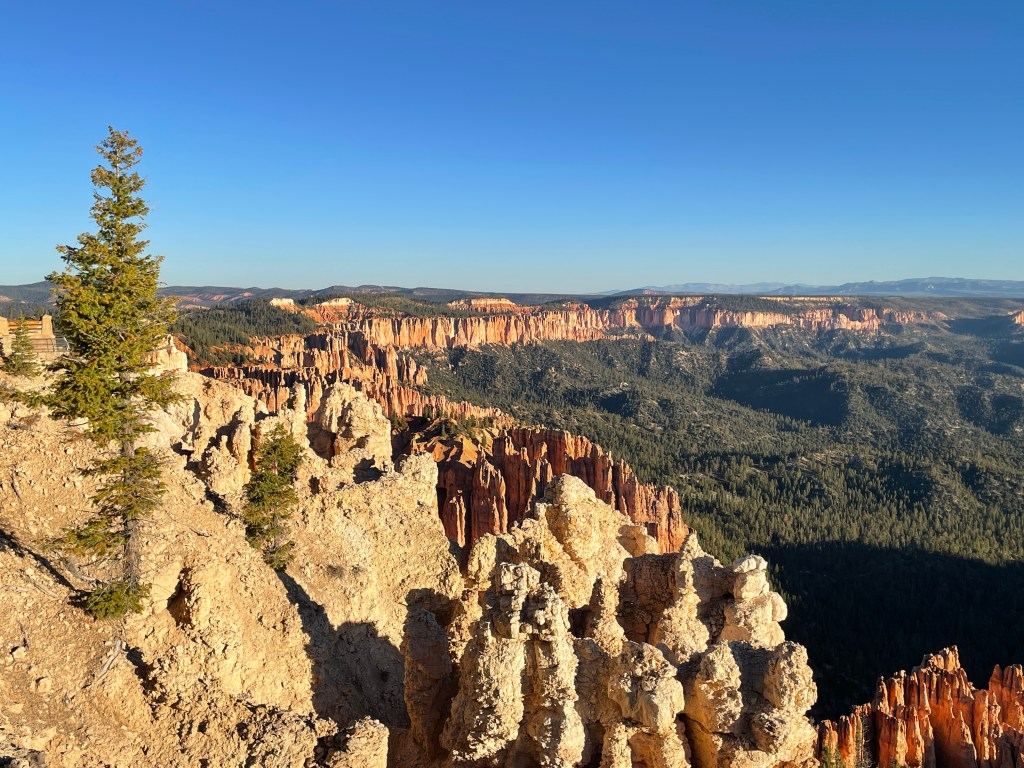
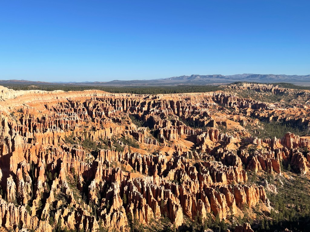
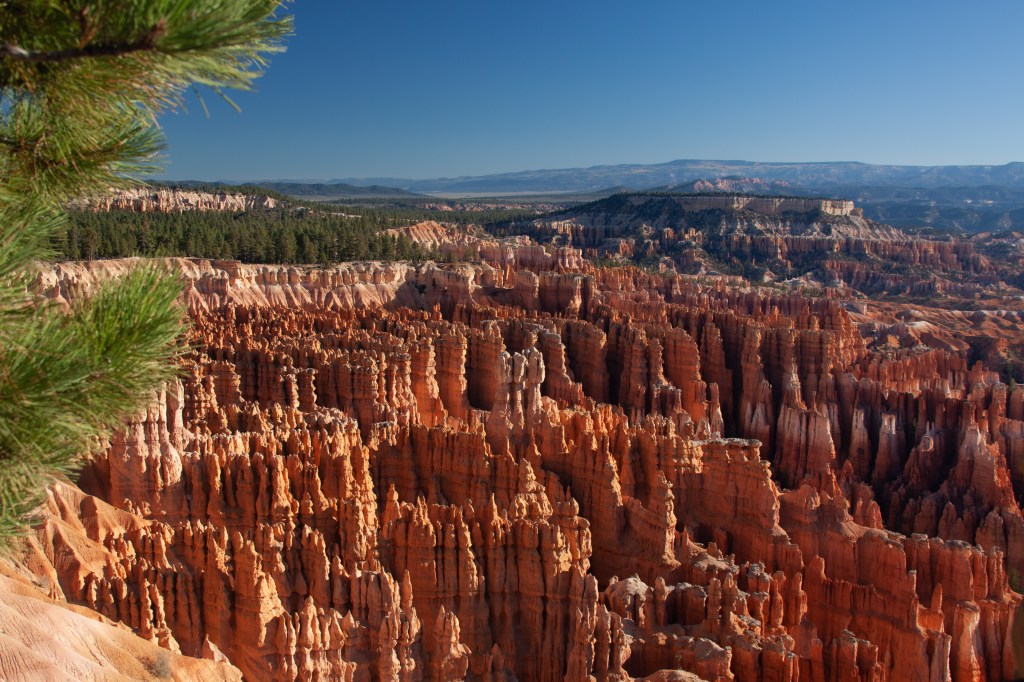
After setting up my trailer, I drove the short distance to Sunset Point, figuring since it was near sunset, there must be a reason for the name. There is. The canyon, hoodoos and rock formations are facing toward the southeast. As the sun sets, its light reflects off the sunny side of each spine or rib of rock, onto the outward faces of the next parallel spine. This makes it appear as if each spine is lit from within. It is like those translucent pink salt sculptures that do have an inside light.
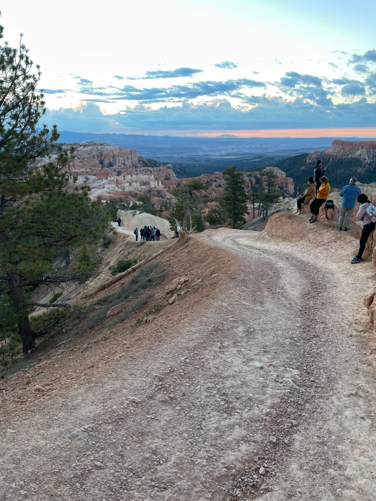
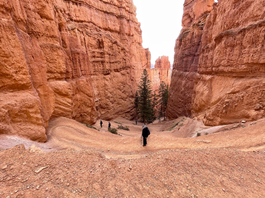
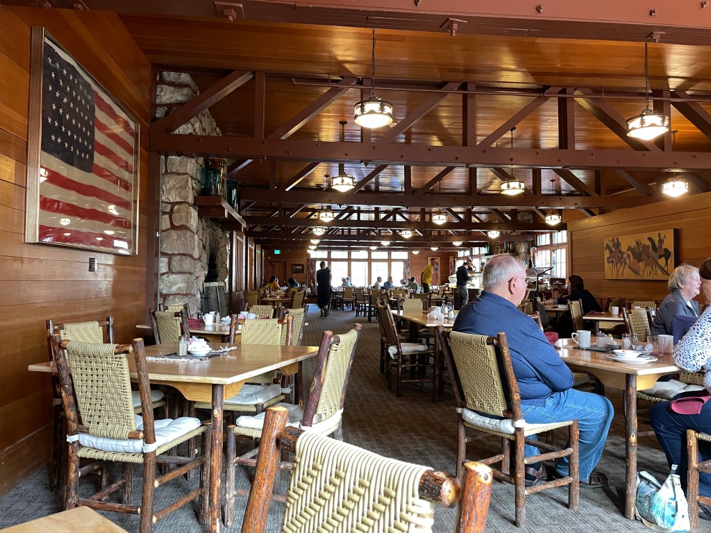
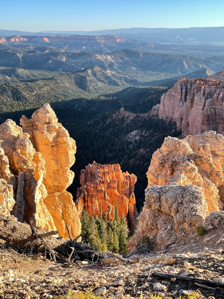
On Sunday, I decided to test my nerves and hike from the rim down into the canyon, or shall we call it the abyss. I am not a person who likes heights and often feel a little queasy when looking out over a drop off. This is especially true when I look through a camera lens at the same time. I knew that the first part of the trail is somewhat exposed as you leave the rim. What happens though, if you make it down, but then you are hit by fear when you have to ascend back to the rim. So, at sunrise I started downward from Sunrise Point on the Queen’s Garden Trail. That trail merges with the Navaho Loop Trail and ends up back at the rim at Sunset Point. Then I would hike the rim trail back to my truck. If I get back up, I would reward myself with and “all you can eat” breakfast buffet at the Bryce Canyon Lodge, half way back to the start point.
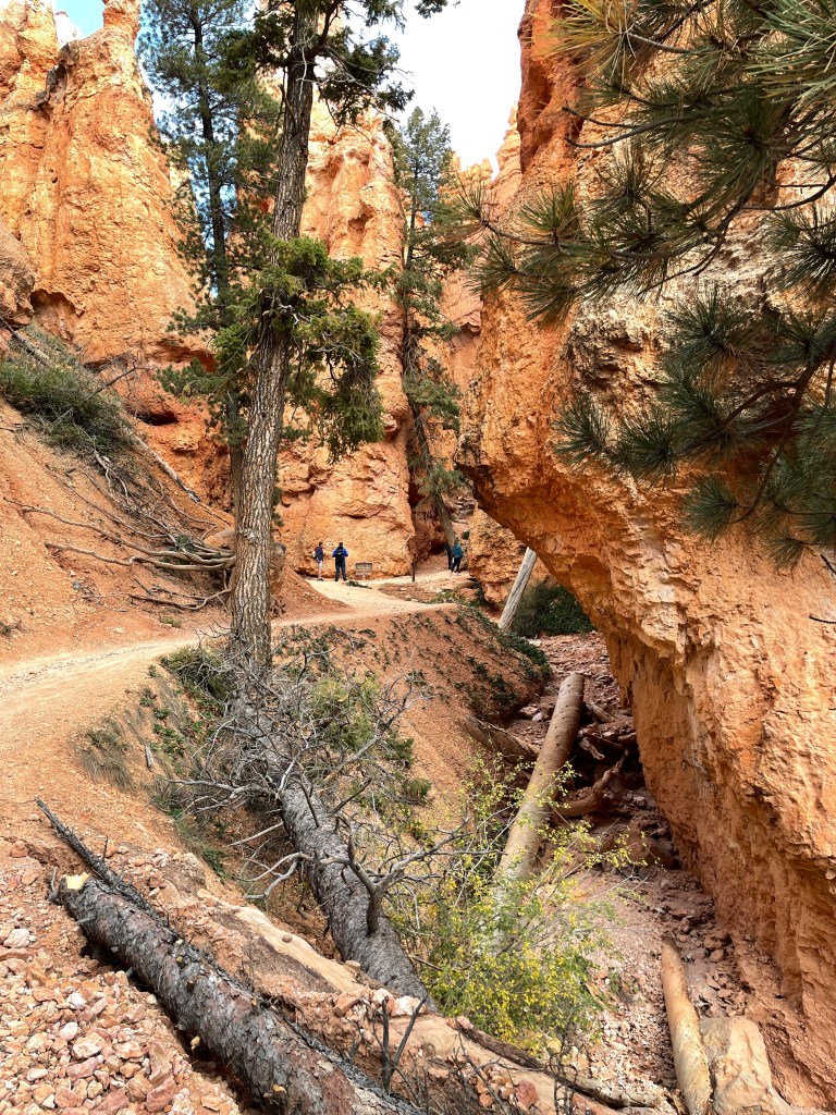
I began the descent shortly before sunrise, along with a lot of other hikers. The trail was pretty wide, so I stayed on the inside edge where possible. Where there was a steep drop off, I kept my eye on the trail, and did not look down.
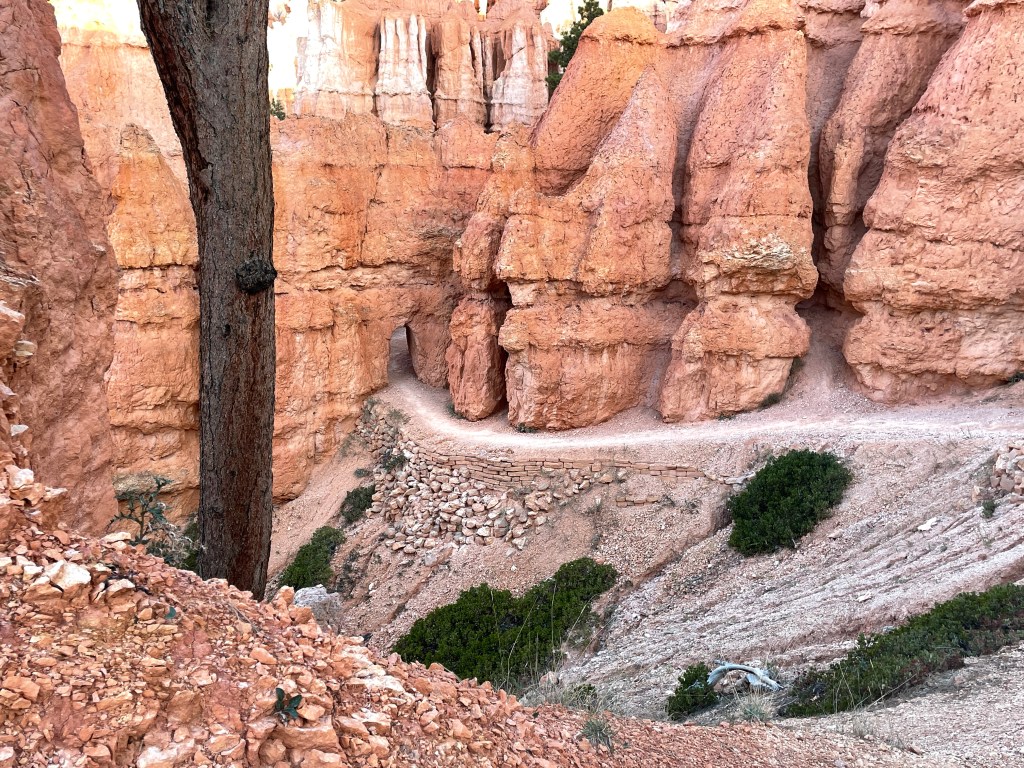
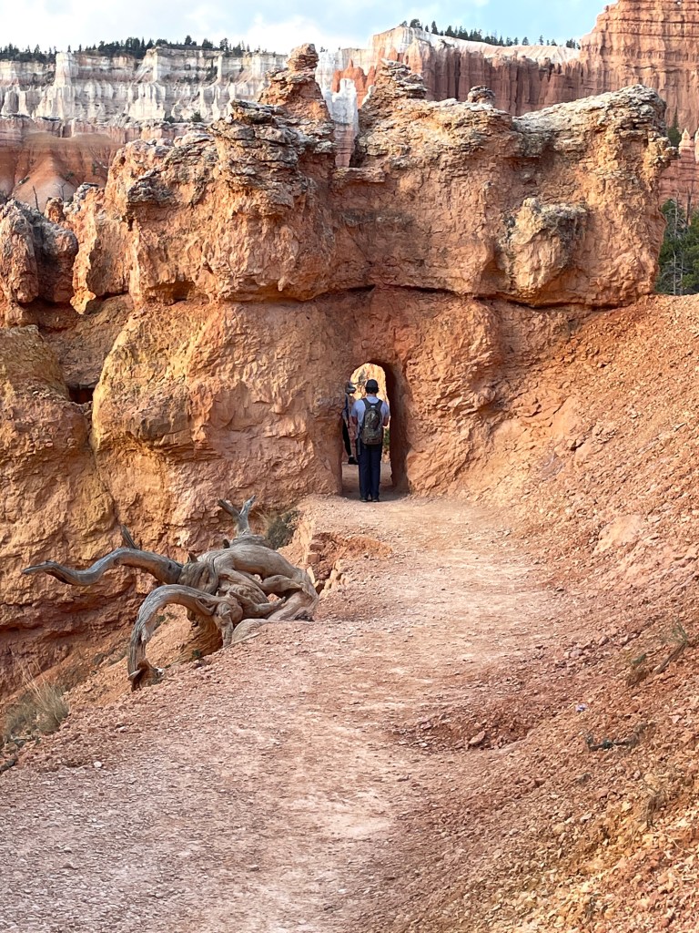
Some of the spines came to a point with no way to build the trail around them. So, they cut portals through the rock.

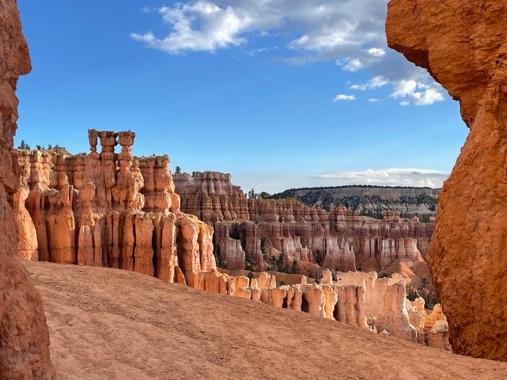
I took a short spur trail into the Queen’s Garden itself. It got its name from a rock formation that looks like Queen Victoria, hands folded over her stomach, looking out over the garden.

Once down in the canyon bottom, I crossed a winding flat area over dried creek beds, before starting the climb back to the rim. The trail winds into a slot canyon that gradually widens out forming a “funnel” of switchbacks that expand outward as you ascend.

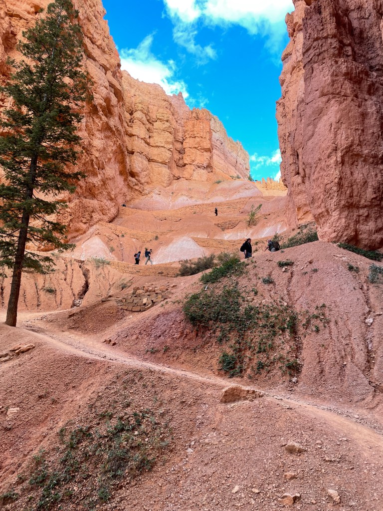
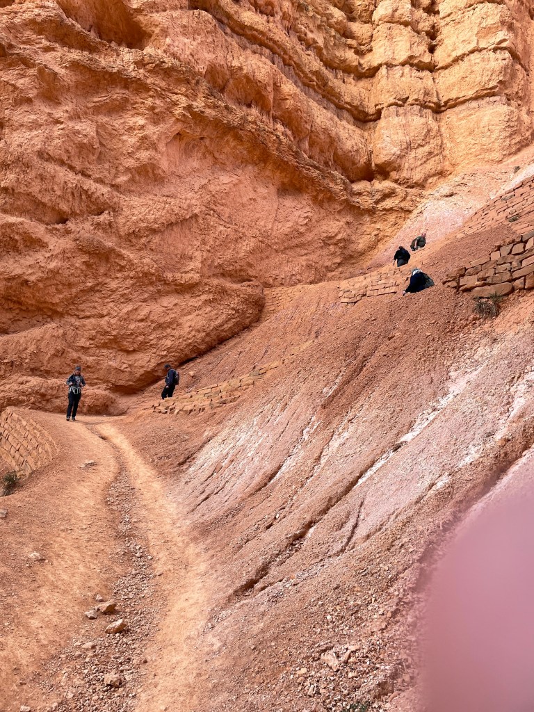
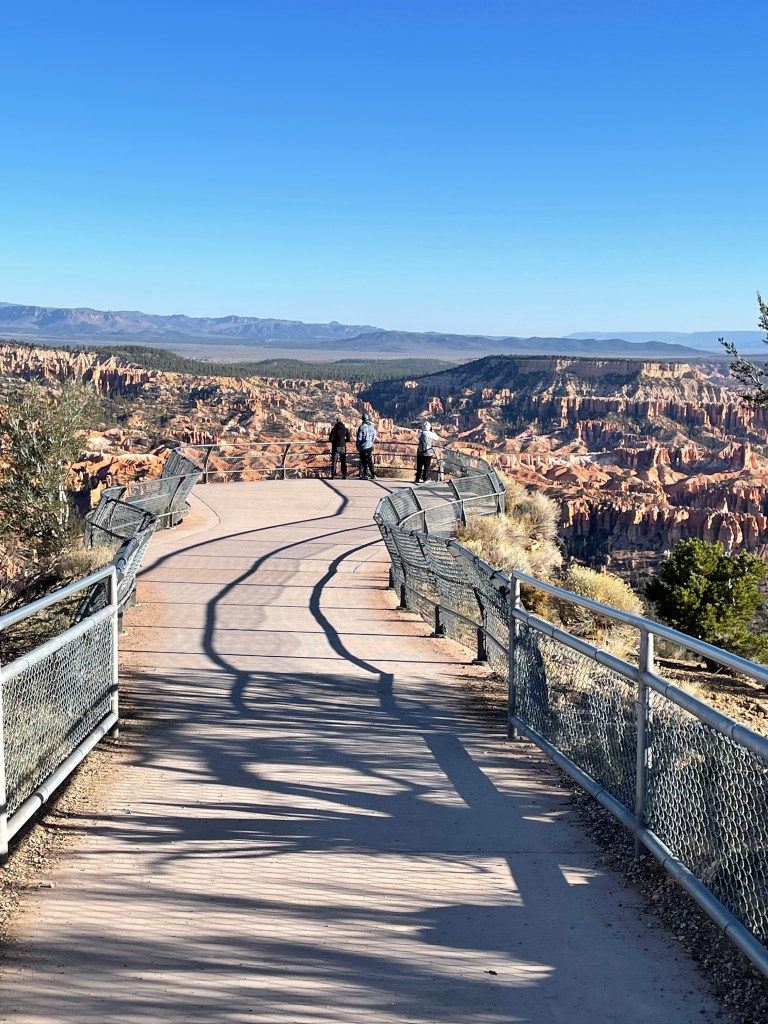
The trail begins to wind again, once past the switchbacks, and again becomes exposed. This section of trail was a little bit intimidating, but I stayed to the uphill side and avoided looking over the edge. Eventually you come to a final two switchbacks that have a chain link fence along the exposed side. After that you are back on the rim. All you can eat eggs, bacon and sausage are just 1/2 miles away.

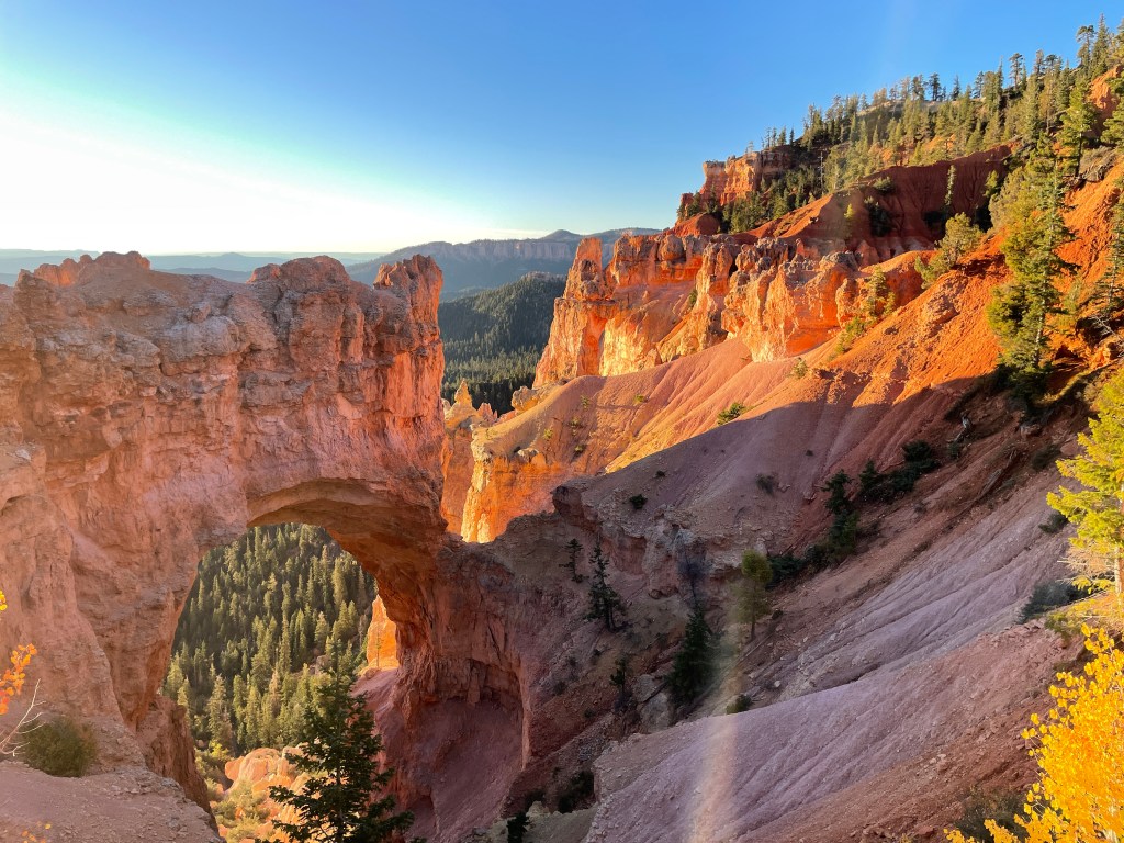
After resting and recharging the trailer batteries on Monday, I decided to do a sunrise drive to the upper end of the park on Tuesday. With a morning temperature of 31, I passed several meadows of frosted grass and a small group of Mule deer before climbing to the last overlook, Rainbow Point. On the return, there are additional points including Natural Bridge.
Perhaps because it is now October, visitors seem to be only arriving for 1 night stays. Each morning the campground emptied out and then in the late afternoon, filled up again. A good percentage of travelers were from Germany or were French Canadians from Montreal. This led to many interesting conversations. A card was clamped on a post at each occupied campsite with a number on it. This number was your departure date. I seemed to invite questions, as my number was 11, while most other sites cycled forward, 01, 02, 03, etc. With each passing day, I became the “old timer”. My only question, unspoken, was why would you came to such a beautiful place, with so many things to see and do, and only stay 1 day.
My next destination, Zion, is generally 10-12 degrees warmer than Bryce, so as the 11th approaches, I will decide whether to extend my stay here, or if nightly lows go below freezing, head on to Zion. I am chased by the weather.

Oh, my, majestic is what comes to mind. The pics are incredible. I can not begin to imagine what the settlers thought as they came to this area.
LikeLike