Saturday, September 24th, 2022
The Utah State Park, Dead Horse Point, lies between Arches and Canyonlands National Parks, atop a mesa overlooking the Colorado River. It is a less visited park, so I decided to hike on a Saturday. I still arrived there at 6 a.m. so as to avoid any vehicles that might line up at the entrance. At an hour before sunrise, there were none.
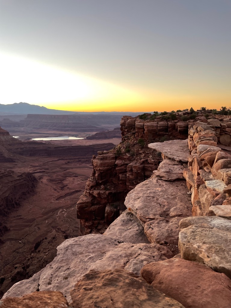
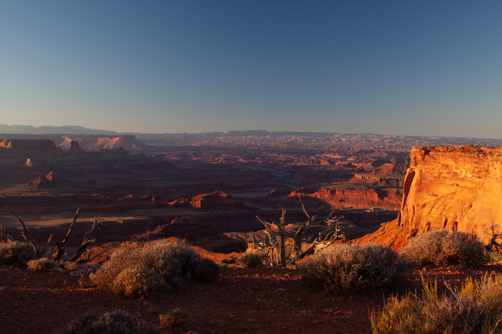
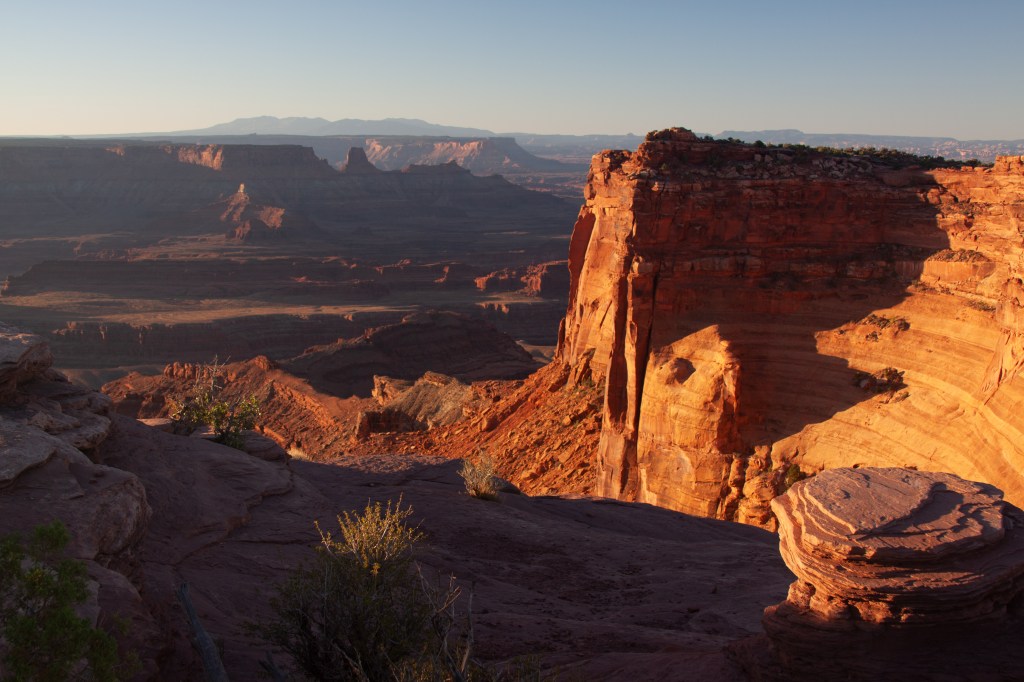
I used my ATM card in the automated entry box, and drove on to the Visitor Center which is situated near the East Rim. My intent was to hike the East Rim Trail out to the point and loop back on the West Rim Trail for a total distance of about 5 miles. First, however, I sat in the dark overlooking the empty expanse of the canyon, drinking my coffee, and waiting for the sun to peak over the La Sal Mountains.
As in Arches National Park, I wanted a chance to see a snake before it bit me. In addition, I did not like the thought of walking along a path next to a 2000 foot drop-off, and not be able to see what my feet might be stumbling over.
Once the sun appeared, the show began…
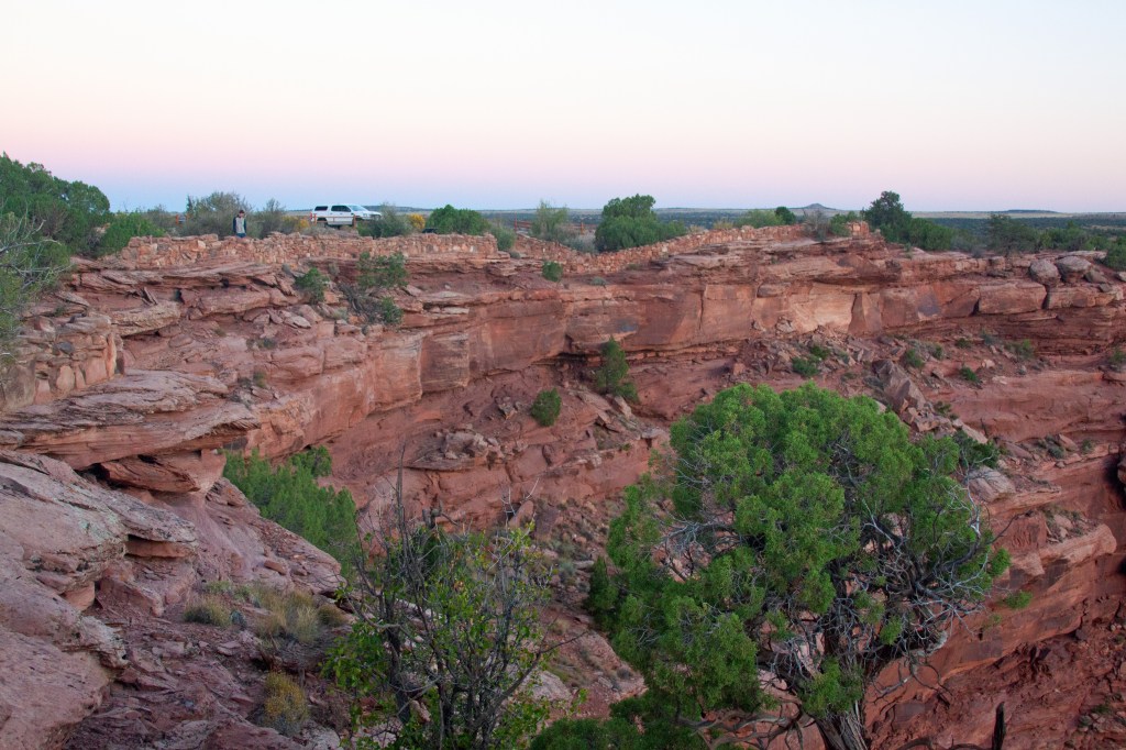
The East Rim Trail followed close along the edge of the mesa and after 2 miles, came to the point. Between the wider top of the mesa near the Visitor Center and the point, the top narrows down to a neck that is only a few yards wide. Once past the neck, the mesa widens out in a diamond shape, ending at the point. All around the edges are shear cliffs dropping to the valley below.
In the 1800s, cowboys would herd mustangs past the narrows and onto the flat point. Then, barricading off the neck, the horses were trapped until taken back to their ranch. The story is told, that on one occasion, they choose to take only the better mustangs, leaving the rest on the point. Without thinking, they left the barricade up. For whatever reason, they did not return, and the horses died of thirst. Thus, we have today’s name of the park, Dead Horse Point.
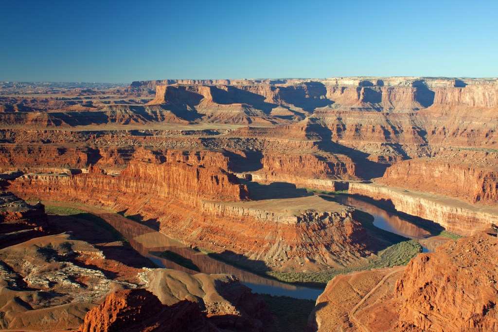
There is a parking area, toilets and picnic tables at the overlook. This morning, however, only 2 people were there. It appeared to be a professional photographer and a model. She removed here jacket, revealing designer jeans and sleeveless shirt and at his behest, climbed on top of a very exposed boulder. There, balanced over the precipice, she assumed various poses while his shutter clicked. I hope she was paid a lot.
I continued on to the West Rim Trail, where the mesa across the way was lit up orange and red by the morning sun. Those canyon walls were within Canyonlands National Park. At times it was a little difficult to keep to the path, as it crossed over sand and slick rock. The rock left no foot prints, so the trail was intermittent. In some places, yellow dashes were painted every few yards. Others, small rock cairns marked the trail. When the path deviated sharply, there was usually a wind weathered spruce branch laid to block the way, or at times, a series of small stones left in a line. I did consult my GPS a couple of times to make sure I was heading the right way. I think the little 3-4 inch lizards that skittered back and forth across the rock, were laughing at me.

Next up, a stroll in Canyonlands National Park.
